PRODUCTS
Based upon our engineering staff’s decades of experience in the software and environmental engineering fields, Streams Tech, Inc.’s software lab has created products that solve market needs. We believe that offering products that improve the environment and make data and information more widely available create tremendous social and financial value. Some of our products include:
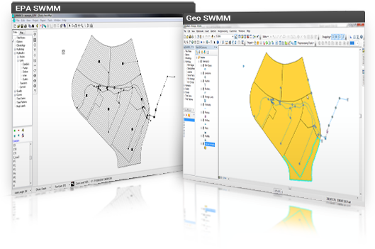
GeoSWMM™
The EPA’s SWMM is a standalone urban water model which stores data in simple text files, requiring users to preprocess and manually prepare model input data from geographic information system or CAD data files. Streams Tech, Inc. has developed GeoSWMM™, a custom ArcGIS® based data processing and management tool for EPA’s SWMM, allowing users to set up and run the model without ever leaving the GIS environment. GeoSWMM allows users to efficiently manage and prepare input data and minimize the potential for data errors.
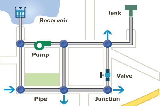
WaterNAM™
WaterNAM (Water Network Analysis Model) is a geospatial hydraulic model developed by the Streams Tech, Inc. for analysis and design of water distribution systems. It performs both steady state and extended period simulation of water flow and quality, including constituent concentrations and fire-flow analyses, and energy-cost assessment. WaterNAM utilizes United States Environmental Protection Agency’s EPANET software as its simulation engine and ESRI’s ArcGIS®environment for spatial data development and model user interface providing a robust platform for engineers to design, analyze and optimize different components of a water distribution system.
QStats
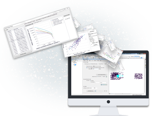
QStats performs statistical flood-frequency analyses of annual-maximum flows following the procedures recommended in Bulletin 17B of the Interagency Advisory Committee on Water Data (1982). QStats locates USGS peak flow gages in an area of user’s interest and obtains and analyzes gage data — all in less than a tenth of the time that is required using the traditional approach. It allows users to perform hydrologic analysis and design of culverts, pipes and bridges, flood mitigation, dam safety and levee certification.
WDM Toolkit
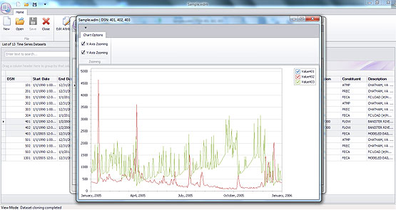
WDM stands for Watershed Data Management. WDM files provide users a powerful tool for managing and manipulating time-series data. A tool is required to create and work with WDM files that would enable users to update or build WDM meteorological files without learning the detailed logistics of WDM operations. The tool is referred to as the WDMToolkit. Data storage and retrieval are critical steps for most water resources models. The goal of the WDMToolkit program is to serve as a utility which will allow users to import available meteorological data into WDM files and perform required operations such as editing, deleting, adding data, clone data, changing dataset number, aggregation, filling missing data, etc. Further, WDMToolkit enables users to input, update and get output of hydraulic, hydrologic and water quality data.
Trace
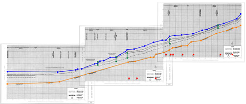
Trace allows users to digitize graphs to capture numeric values from images, especially when the data that were used to generate a graph is unavailable. Trace can handle a large graph sliced into many images, both horizontally and vertically. The National Flood Insurance Program (NFIP) of US Federal Emergency Management Agency. (FEMA) studies flood prone areas along streams and shorelines and FEMA’s Flood Insurance Study (FIS) reports include water surface elevation profiles for different recurrence intervals. In making changes to previously studied areas, it is necessary to compare proposed water surface elevations with the ‘effective elevations.
HourPad
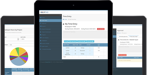
Time tracking is an essential component of any business. HourPad™ makes time tracking and timesheet submission and approval straightforward and simple. HourPad is easy to use and there are no limits to the number of clients and projects that you can add to the timesheet. It’s also secure and safe, and can be hosted at your company internally. Tracking tasks and projects is even easier with HourPad’s reporting.
Adopt a Hydrant
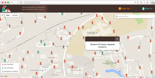
Adopt-a-Hydrant is a web-based application which allows citizens to take responsibility and clear fire hydrants in their neighborhoods after it snows. Cooperation of citizens minimizes delays in extinguishing fires and saving life and property. The simple Adopt-a-Hydrant interface allows citizens to view fire hydrants on Google Maps and adopt one or more of them either online or by contacting the administrator. The administrator of the program has full control over the application, including complete access to the volunteer database. Adopt-a-Hydrant provides an all-inclusive package that hosts client’s website, mapping data and user information. No third party software or subscription is required.
