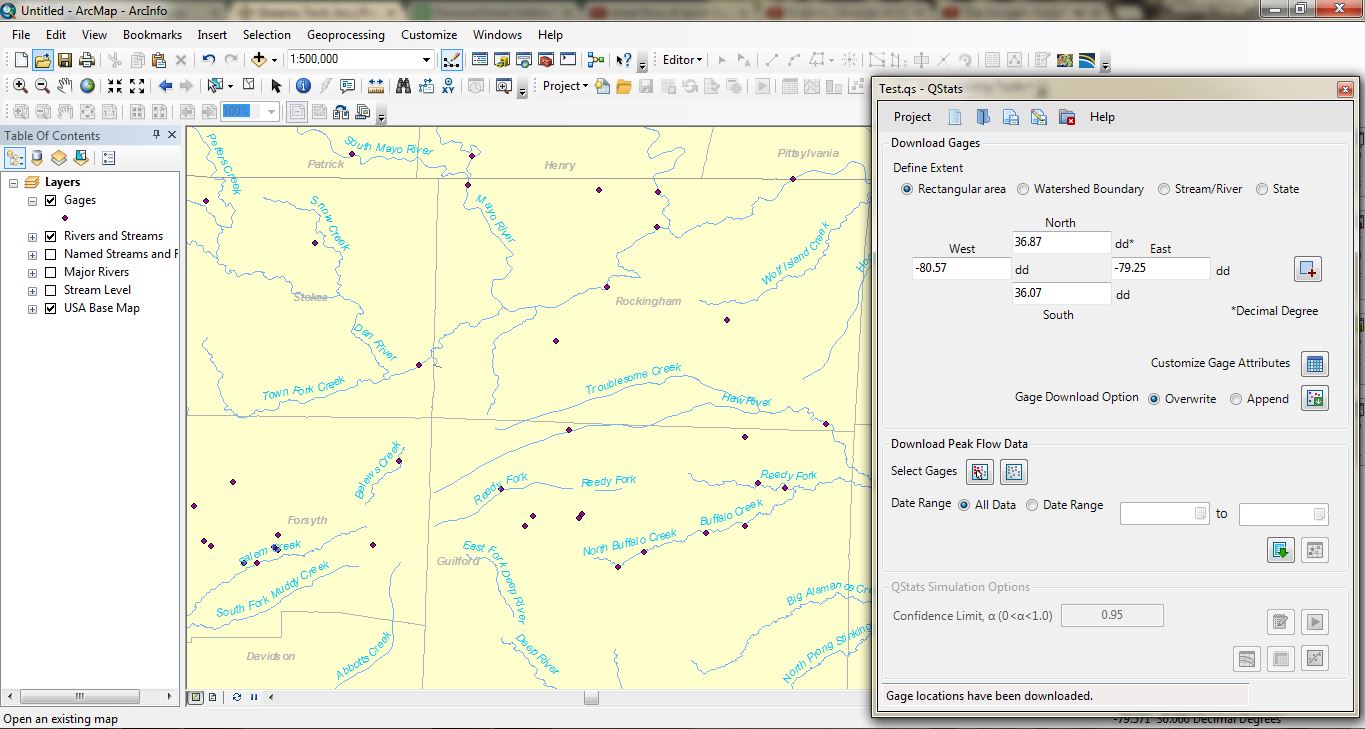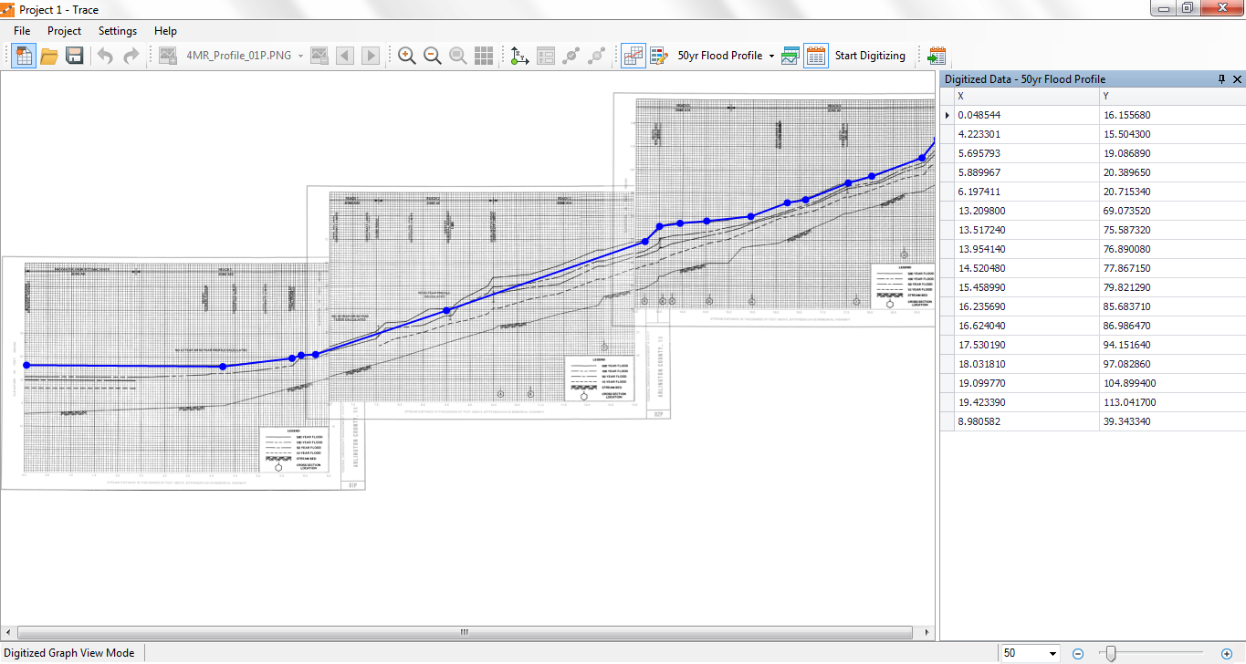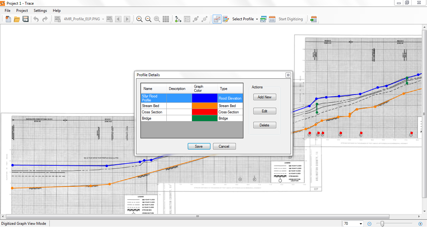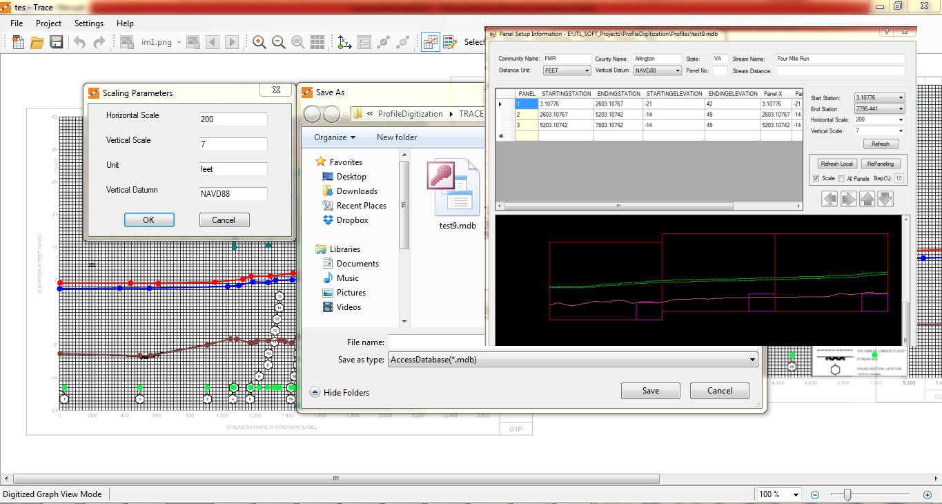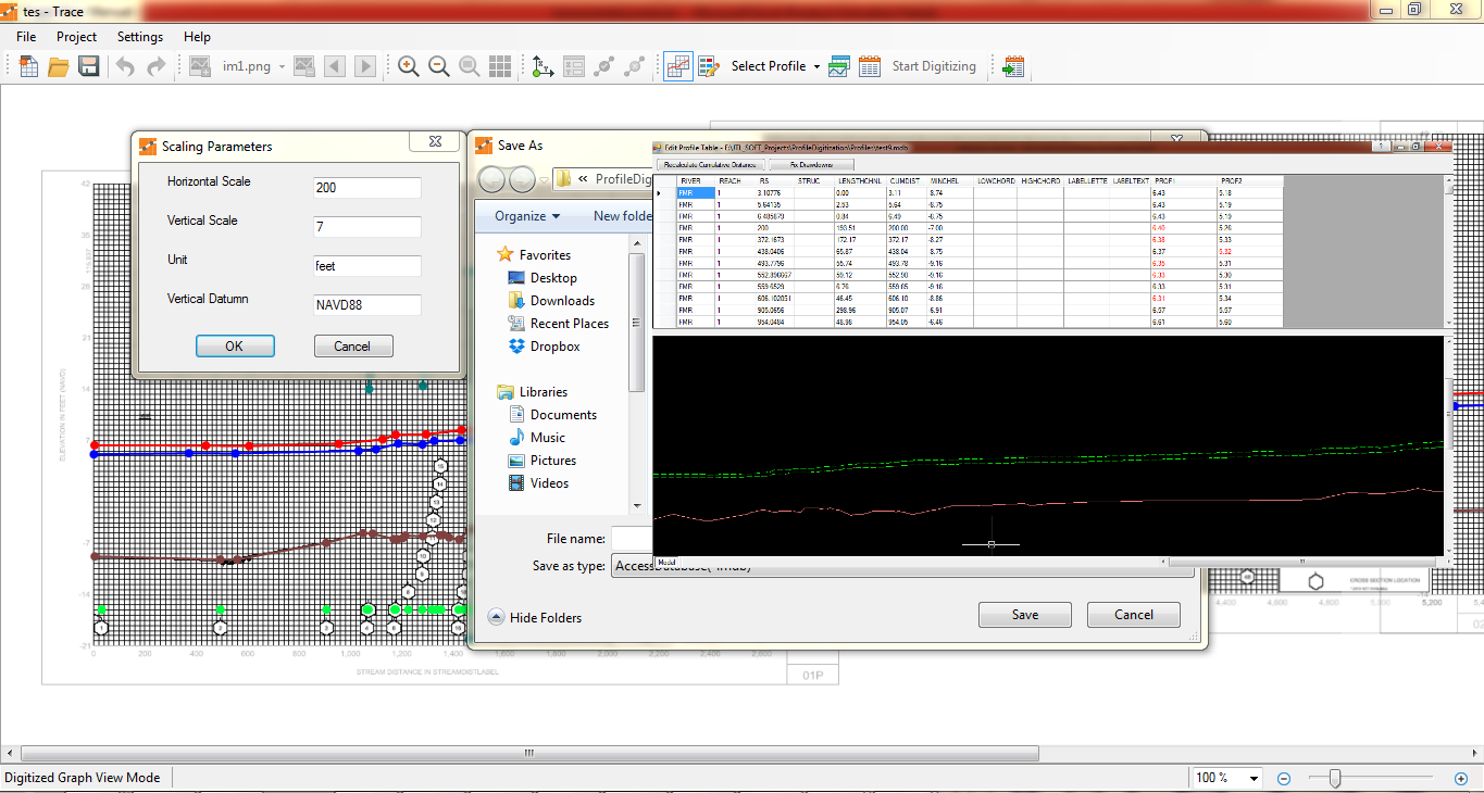


Trace™ allows users to digitize graphs to capture numeric values from images, especially when the data that were used to generate a graph is unavailable. Trace can handle a large graph sliced into many images, both horizontally and vertically. The National Flood Insurance Program (NFIP) of US Federal Emergency Management Agency. (FEMA) studies flood prone areas along streams and shorelines and FEMA’s Flood Insurance Study (FIS) reports include water surface elevation profiles for different recurrence intervals. In making changes to previously studied areas, it is necessary to compare proposed water surface elevations with the ‘effective elevations.’ For many old studies the effective water surface elevations are available only in hardcopies. Trace allows users to digitize water surface profiles from hardcopy graphs that span multiple sheets, making graph digitization for the redelineation of flood plain boundaries, based on new topographic data, much easier and less time consuming.