


What is WaterNAM?
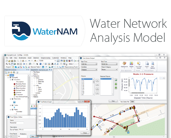
The Water Network Analysis Model (WaterNAM™) is a geospatial hydraulic model for analysis and design of water distribution systems. It performs both steady state and extended period simulation of water flow and quality, including constituent concentrations and fire-flow analyses, and energy-cost assessment. WaterNAM utilizes U.S. Environmental Protection Agency’s EPANET software (version 2) as the simulation engine and ESRI’s ArcGIS® for spatial data development, providing a robust platform for engineers to design, analyze and optimize different components of a water distribution network. The extension allows users to efficiently set up a model and perform hydraulic and water quality simulation entirely within the ArcGIS®system.
What are the typical applications of WaterNAM?
WaterNAM can be applied to
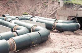
Model, design and analyze any
water distribution system
components
Design and optimize
distribution pipe sizes and
compute friction loss across
the pipe network

Perform fire-flow analysis and
design hydrant capacities

Model constant or
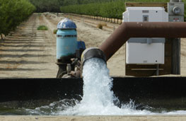
variable speed pumps, pumping system
arrangement and their
control operation
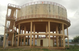
Model and design storage
tanks, and optimize
tank operation (with or without pump control)

Flood plain
mapping of natural
channel systems
Estimate leakage losses,
pressure dependent flow and
flow from the emitter type
nodes
Model chemical constituent
quality and movement
throughout the network
How is WaterNAM different from other similar water distribution models?
For hydraulic and water quality modeling of distribution networks, EPANET is referred as the fundamental program, and it’s one of the most widely used applications in this sector. However, there are a number of advanced commercial packages available also like WaterCAD, InfoWater, KYPipe etc. Each of them have their own classified features for the modelers. In this aspect, WaterNAM joins the market with its unique credibility by bringing a geospatial environment in ArcGIS® platform for the EPANET software, and obviously with reduced amount of cost and modeling effort for the users (compared to other applications).
Any experienced modeler would agree with the fact that preparing input data for a sophisticated model takes the lion’s share of his/her total modeling time. Besides, the data processing for a large distribution model often becomes monotonous and complex simultaneously. By integrating EPANET within ArcMap™, WaterNAM helps users to significantly reduce the time it takes to prepare model input, makes data processing almost automated, increase the accuracy of input data, store and manage data in a database environment and visualize and inspect model objects on a map. It allows users to run simulation and view output without ever exiting the GIS environment.
WaterNAM Highlights

100% Compatible with EPANET software

No Learning Curve for ArcGIS® and EPANET users

Model setup, simulation and output visualization completely within ArcGIS®

Unrestricted access to ArcMap functionalities

Support of queries and reporting of data stored in a file geodatabase

Tabular view of input and output data

Export EPANET input and scenario files
Special Tools
![]() Network Analysis tool
Network Analysis tool
![]() Model creation from existing GIS data
Model creation from existing GIS data
![]() GIS data Append option in the existing model
GIS data Append option in the existing model
![]() Data management in a file geodatabase
Data management in a file geodatabase
![]() Automatic pipe length calculation
Automatic pipe length calculation
![]() Export EPANET input and scenario files
Export EPANET input and scenario files
![]() Control rule editor
Control rule editor
![]() Enhanced tabular view of model data
Enhanced tabular view of model data
![]() View Profile Plot
View Profile Plot
![]() View Time Series Plot
View Time Series Plot
![]() View Time Series Comparison
View Time Series Comparison
![]() View Reaction Report and Energy Report
View Reaction Report and Energy Report